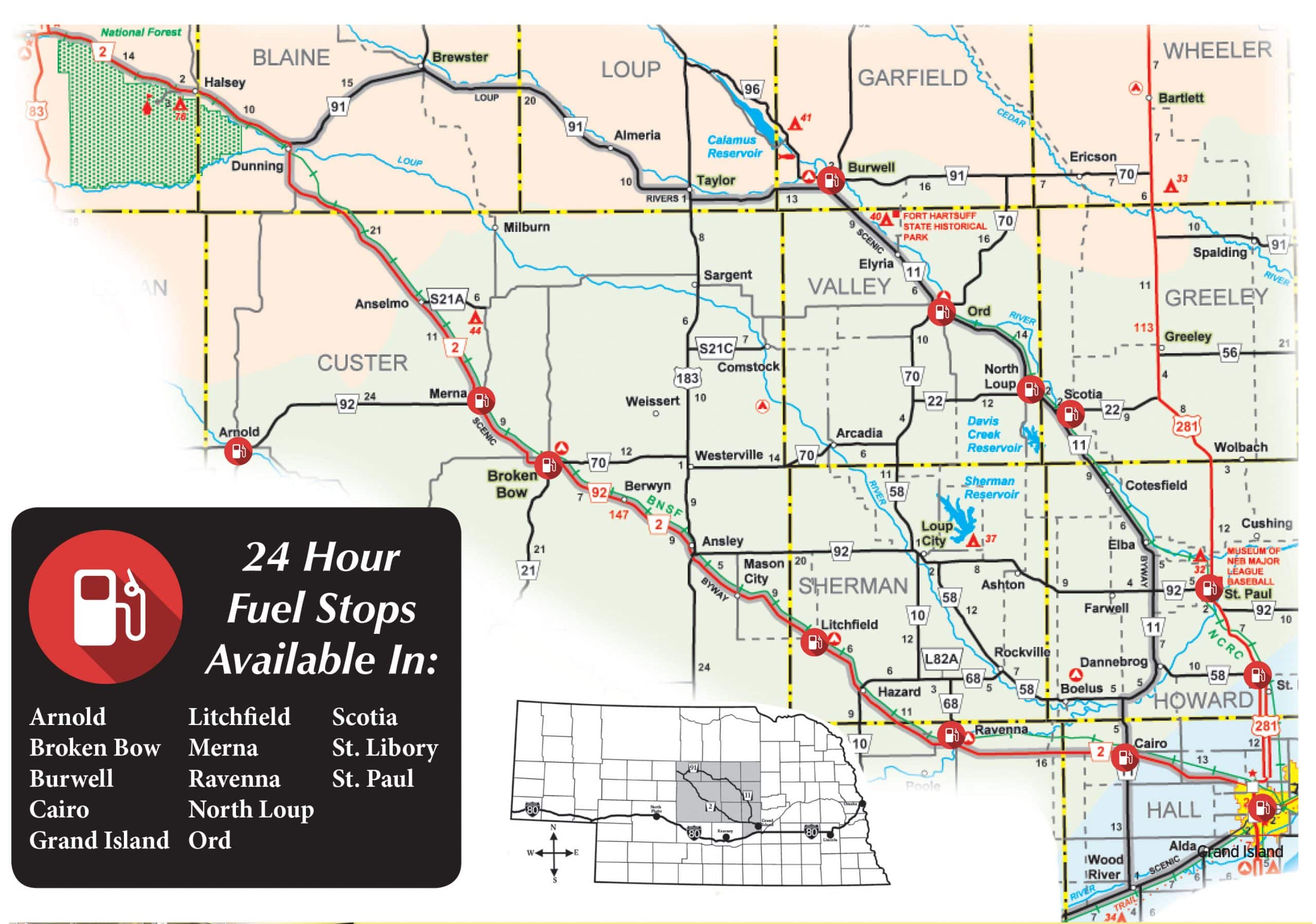
NEBRASKA’S JUNK JAUNT® takes place in central Nebraska. Two of Nebraska’s most beautiful Scenic Byways, The Sandhills Journey Byway and the Loup Rivers Scenic Byway, form the basic “looping route” of the JUNK JAUNT®. Also included, and a very important part of this fun event, are the numerous small towns and villages on the east, the west and on the inside of the “looping Byway/JUNK JAUNT® route.”


![]() Towns on Highways 11 (alphabetical order)
Towns on Highways 11 (alphabetical order)
Burwell | Print a community map
Cairo | Print a community map
Cotesfield | Print a community map
Dannebrog | Print a community map
Elba | Print a community map
Elyria | Print a community map
North Loup | Print a community map
Ord | Print a community map
Scotia | Print a community map
Wood River | Print a community map
![]() Towns on Highways 91 (alphabetical order)
Towns on Highways 91 (alphabetical order)
Brewster | Print a community map
Burwell | Print a community map
Dunning | Print a community map
Taylor | Print a community map
![]() Towns on Highway 2 (alphabetical order)
Towns on Highway 2 (alphabetical order)
Anselmo | Print a community map
Ansley | Print a community map
Berwyn | Print a community map
Broken Bow | Print a community map
Cairo | Print a community map
Dunning | Print a community map
Halsey | Print a community map
Grand Island | Print a community map
Hazard | Print a community map
Litchfield | Print a community map
Mason City | Print a community map
Merna | Print a community map
Ravenna | Print a community map
Thedford | Print a community map
Towns West of Byway – Hiway 2 (alphabetical order)
Arnold | Print a community map
Callaway | Print a community map
![]()
![]()
![]() Towns inside the Byway loop (alphabetical order)
Towns inside the Byway loop (alphabetical order)
Arcadia | Print a community map
Ashton | Print a community map
Boelus | Print a community map
Comstock | Print a community map
Farwell | Print a community map
Loup City | Print a community map
Rockville | Print a community map
Sargent | Print a community map
Westerville | Print a community map
![]() Towns East of Byway-Hiway 11 (Hwy 281) (alphabetical order)
Towns East of Byway-Hiway 11 (Hwy 281) (alphabetical order)
Alda | Print a community map
Bartlett | Print a community map
Ericson | Print a community map
Greeley | Print a community map
St Libory | Print a community map
St Paul | Print a community map
Wolbach | Print a community map